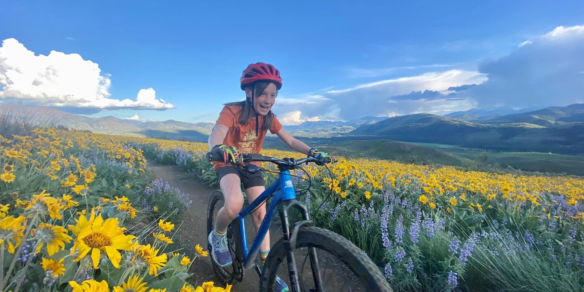
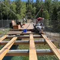
Trails are running, riding, and walking well this summer, with our usual summer maintenance hitting trails daily. The last few weeks we have been mowing Big Valley, sections of the Methow Community Trail, some Sun Mountain trails, Winthrop trails, and Mazama trails. A tremendous effort is going into replacing over 1,000 pieces of wood on our iconic Tawlkes Foster Suspension bridge. The bridge is closed during active work times, typically 8:30-3:30 on Tuesday, Wednesday, and Thursday, likely through the week of July 17th. Another big project for us is our Cub Creek trailhead development, which should start in July, and phase 1 should be finished by November 1st. The new Winthrop bike park is also complete and ready for all riding levels! Come check it out. Finally, we are constantly working on securing the access we all have grown to know and love. THANK YOU to our current landowners. We could not do this without your support. Future landowners, we look forward to working with you in making vital recreation and transportation connections in our community.
See you on the Trails!
Rendez Vous+
| ABC | Distance | Open | |
|---|---|---|---|
Buck Mountain | 15.66km | ||
Buck Mountain FS Road | 4.44km | ||
Buck Up | 5.33km | ||
Cassal Creek Loop (black) | 0.75km | ||
Cassal Creek Loop (blue) | 1.72km | ||
Cassal Hut | 0.81km | ||
Cedar Creek Loop (black) | 1.87km | ||
Cedar Creek Loop (blue) | 4.14km | ||
Cougar Bait | 1.32km | ||
Cougar Mountain Loop | 4.64km | ||
Cow Creek | 4.23km | ||
Cub Creek | 3.47km | ||
Grizzly Hut | 0.5km | ||
Grizzly Mountain Loop | 1.59km | ||
Grizzly Way | 1.09km | ||
Gunn Ranch | 4.93km | ||
Heifer Hut | 1.26km | ||
Little Cub Creek | 5.22km | ||
Lower Rendezvous Basin | 1.48km | ||
Lower Rendezvous Pass | 2.57km | ||
Rendezvous Basin | 2.29km | ||
Rendezvous Pass | 1.12km | ||
Sick Joke Hill | 2.14km | ||
Upper Cougar Bait | 4.13km | ||
Upper Fawn Creek | 2.5km |
Sun Mountain+
| ABC | Distance | Open | |
|---|---|---|---|
Aqua Loop | 2.01km | ||
Beaver Pond | 1.78km | ||
Blue Jay | 3.09km | ||
Cabin | 0.86km | ||
Chickadee | 1.1km | ||
Climb-It Change Upper | 2.39km | ||
Coal Creek Trail | 8.36km | ||
Criss Cross | 1.1km | ||
Homestead | 0.22km | ||
Little Wolf | 2.48km | ||
Little Wolf Connector | 0.12km | ||
Lower Fox | 0.86km | ||
Lower Inside Passage | 1.42km | ||
Meadow Lark | 4.98km | ||
More Cowbell | 2.94km | ||
Overland | 1.52km | ||
Patterson Mountain | 4.51km | ||
Pete's Dragon | 4.24km | ||
Raven | 0.22km | ||
Rodeo | 2.3km | ||
Shortcut | 0.38km | ||
Sunnyside | 3.09km | ||
Thompson Pass | 1.48km | ||
Thompson Ridge | 2.43km | ||
Upper Fox | 0.75km | ||
Upper Thompson Ridge | 2.39km | ||
View Ridge | 1.33km | ||
Wild Turkey | 1.72km | ||
Woodpecker | 7.72km | ||
Yellow Jacket | 1.88km |
Big Valley+
| ABC | Distance | Open | |
|---|---|---|---|
Big Valley (Inner Loop) | 2.43km | ||
Big Valley (Outer Loop) | 3.61km | ||
Forest Road 5130-100 | 1.95km | ||
Lewis Butte Trail | 5.65km | ||
Methow Community Trail- Wolf Ridge to Browns Farm | 2.66km | ||
National Forest Development Road 155 | 2.74km | ||
Rizeor Lake Trail | 6.01km |
Winthrop+
| ABC | Distance | Open | |
|---|---|---|---|
Fish Hatchery | 0.09km | ||
Meadowlark | 3.28km | ||
Methow Community Trail- Powers Plunge to Wolf Ridge | 1.5km | ||
Methow Community Trail- Winthrop to Powers Plunge | 0.84km | ||
Methow Valley Community Trail- Winthrop to Powers Plunge | 0.43km | ||
Powers Plunge | 2.02km | ||
Rex Derr Trail | 7.76km | ||
Susie Stephens Trail | 0.49km | ||
TWiN | 1.88km | ||
Winthrop Fatbike Snowshoe | 0.11km | ||
Winthrop Trail (Lower) | 3.29km | ||
Winthrop Trail (Upper) | 2.78km |
Mazama & River Run+
| ABC | Distance | Open | |
|---|---|---|---|
Cassal Cutoff | 0.79km | ||
Doe Canyon | 2.21km | ||
Doe Canyon Loop | 0.51km | ||
Early Winters | 0.59km | ||
Founders Trail | 4.27km | ||
Goat Creek | 2.61km | ||
Goat Creek Cutoff | 0.73km | ||
Inn Run Loop | 1.86km | ||
Jack's | 4.69km | ||
Lower Fawn Creek | 4.77km | ||
Lower River Run | 1.4km | ||
Lunachik | 1.6km | ||
Methow Community Trail- Browns Farm to Suspension Bridge Trailhead | 5.58km | ||
Methow Valley Community Trail- Browns Farm to Suspension Bridge Trailhead | 0.07km | ||
Methow Valley Community Trail- Mazama to Freestone Inn | 3.22km | ||
Sandy Butte | 1.76km | ||
Tawlk-Foster Suspension Bridge | 0.07km | ||
Upper Jack's | 1.46km | ||
Upper River Run | 3.8km | ||
Wolf Creek Road | 8.56km |